Tyne Trail Ultra
Starting from the South Tyne source
16 May 2020
The routes are displayed in various formats below, follow the links to download the GPX track. If you need to download a GPX track specific to your device (such as Garmin), then please select from the drop-down menu ‘GPX Track’ shown below.
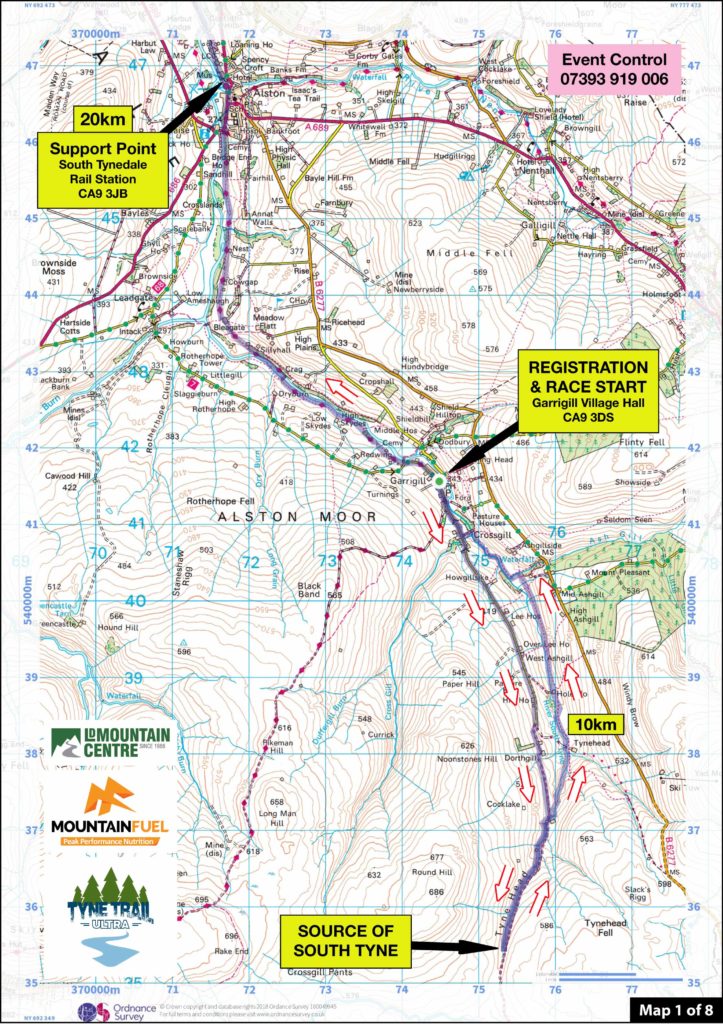
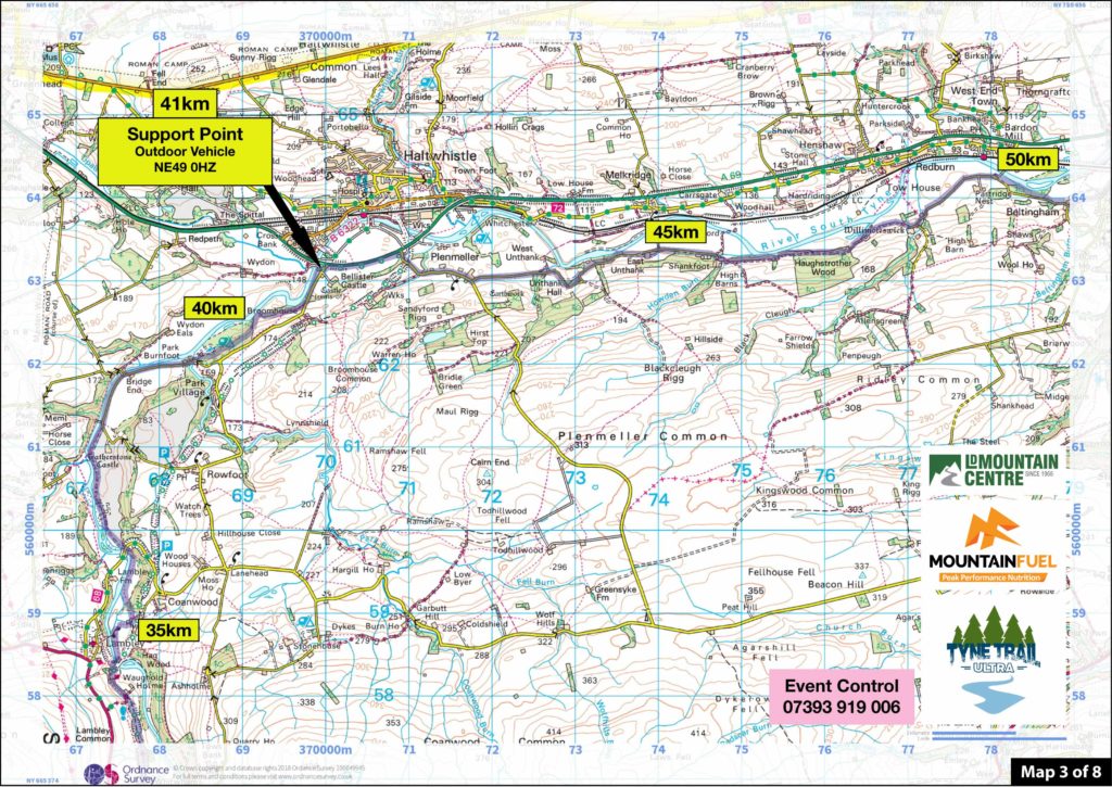
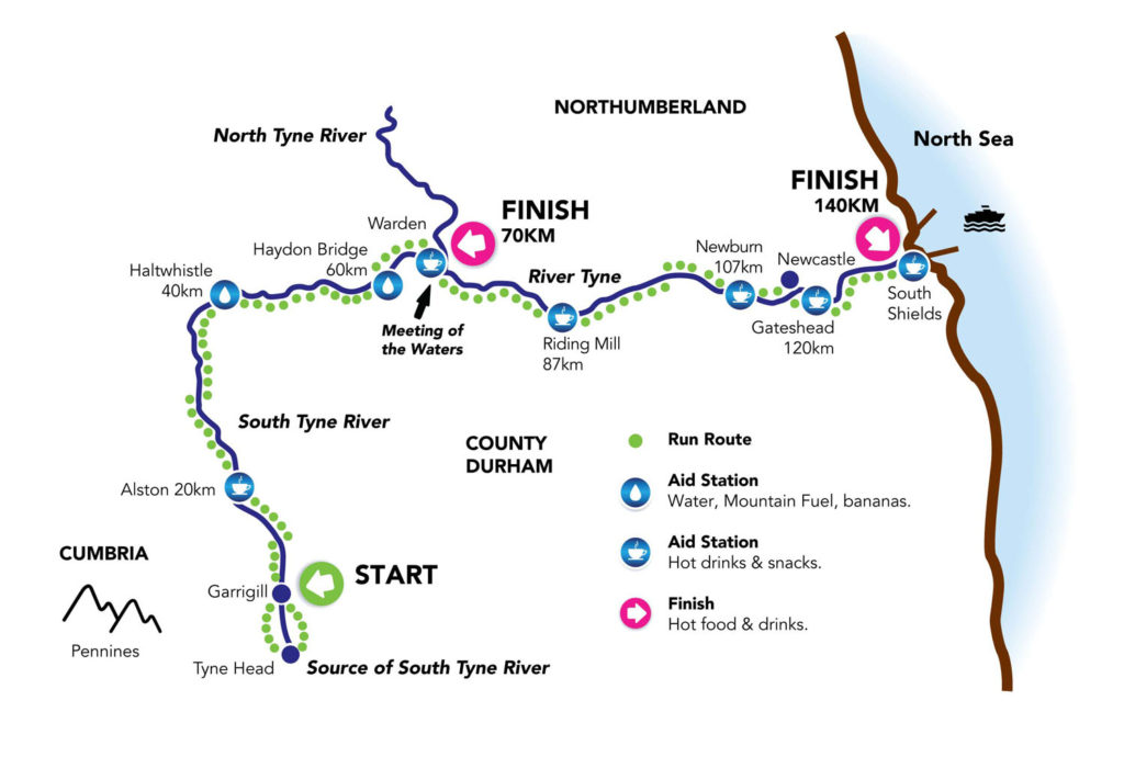
The routes along with Aid Station locations are also displayed below on OS maps and on Google Maps. This is available to download as one file using the button ‘Printable Route Maps’ below (4 pages, A4).